

A short hike through the highest peaks of the Gorgany massif. There is everything you expect from a hike in the Carpathians - few people (much less than on Hoverla), a lot of forest on the approaches (which means there will be a good fire) and an endless sea of stone on the ridge. In Gorgany, in just 3 days you can be 100% immersed in wild nature - come!
Trek plan:
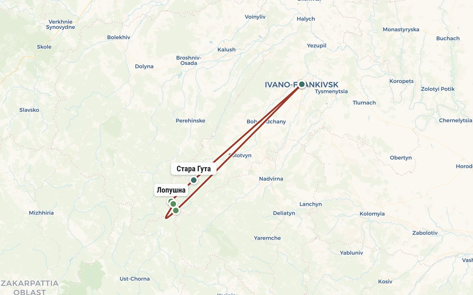
RouteRoute map
 Open the map →
The GPS track is not digitised yet, the line is approximate (by key points).
Along the trailWhat you will see


Day by dayItinerary
1 Day 1. Ivano-Frankivsk - village. Staraya Guta - Borevka valley (11 km)
The group gathers at the Ivano-Frankivsk station around 9 am. We move to the village of Staraya Guta (60 km, one and a half hours), from where, at an altitude of about 700 m, our route begins. We go upstream along the Bystritsa-Solotvinskaya River, go around Mount Zhuravleva Kliva, and then turn off the road. A much steeper climb begins through the forest along the Lopushna River. So we get to its source in the Borevka meadow (altitude 1320 m), where we spend the night.


2 Day 2. Lopushna town - Sivulya town (1836 m) - Malaya Sivulya town - Rushchina meadow (12 km)
We pack up the camp and follow a tricky curve to the ridge of the Gorgany massif. Behind the unnamed peak of 1596 m, the forest retreats and we find ourselves in the kingdom of stone placers, which gave the name to the Gorgans. The trail goes through all the peaks of the ridge and we successively pass Borevka (1695 m), Lopushna (1722 m), Bolshaya Syvulya (1836 m) and Malaya Syvulya (1818 m). In the first half of the 20th century, the Polish-Slovak border passed here and since then some artifacts have been preserved: stone border posts and stone trenches. The world of green (lichen-covered) stone will seem doubly beautiful to you if by this moment the weather does not deteriorate and you do not have to run down to escape a thunderstorm. For the night we go down to the Rushchina meadow to a destroyed tourist shelter (also known as a border outpost) a hundred years ago.


3 Day 3. Peklo tract, sources of Bystritsa Solotvinskaya, Staraya Guta (14 km)
After breakfast we will make a short trek to the picturesque cliffs of the Peklo tract, and after that we will begin our descent. We will pass the source of the Bystritsa Solotvinskaya River and moving along its bank we will plunge into the forest. After lunch we will find ourselves in Staraya Guta and take a minibus to Ivano-Frankivsk. If you plan to leave that same evening, then take return tickets for trains starting after 21:00.
Note. The above describes an optimistic version of the route, for normal weather and a group with an average level of training. Based on weather conditions and the condition of tourists, the instructor can make changes to the route. Changes in the route do not affect the cost of the tour in any way.


ReviewsTraveller reviews
Results: the children are happy, the midges are full, I remember the Carpathians. It's a shame that it's so rare to get out here.


