

A winter trek to Mount Pip Ivan Marmaroskyi - one of the most "alpine" peaks of the Carpathians, called the Ukrainian Elbrus not only for its looks. There are glacial cirques here, mighty rock outcrops and other attributes of high mountains. And in winter the slopes of the mountain become even more beautiful... and more dangerous. Submit your applications in advance, because the state border with Romania runs across the Marmarosy - this is a restricted zone and obtaining a permit takes about 2 weeks.
RouteRoute map
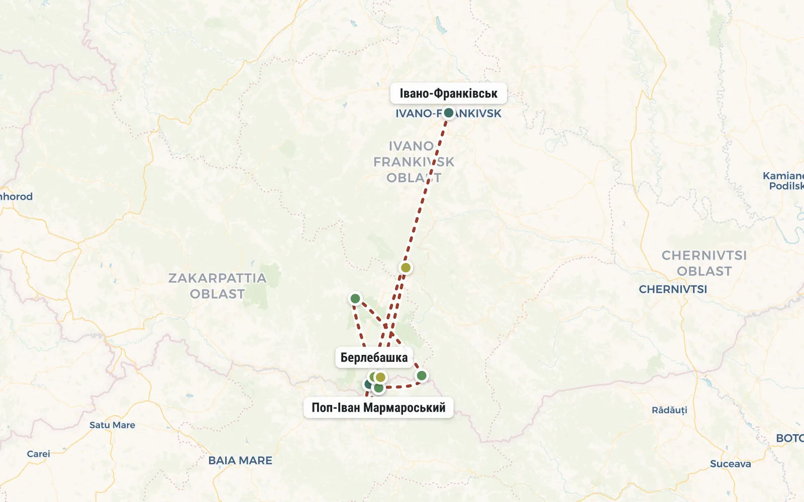 Open the map →
The GPS track is not digitised yet, the line is approximate (by key points).
Along the trailWhat you will see


Day by dayItinerary
1 Day 1. Ivano-Frankivsk, Delovoye village, Lisya valley.
During the first day we need to cover a lot (gain 1100 meters of altitude) and therefore we need to start as early as possible. Usually the group meets at the Ivano-Frankivsk railway station at 7 am. After distributing food and rental equipment, we head to the mountains in a custom minibus. The road can take up to 4 hours (we go through Yaremche, Yablunytsia, Yasinya, Rakhiv), we make a photo stop at the sign “Geographical Center of Europe”. As a result, we arrive at the border with Romania, in the village of Delovoye, where we mark our passes and begin the hike.
We start from a height of 360 m. We go East along the wooded valley of the White Potok River. After about 8 km we will reach the Obnizh tract (altitude about 800 m), where we will take a break for lunch. Further the slope becomes steeper and we will gain the next 600 meters of altitude in just 3 kilometers horizontally. At the end we leave the forest zone and settle down for the night in a hut in the Lisya meadow. This hut will become our base for the next two days.


2 Day 2. Radialka on Pop Ivan Marmarossky (1938 m)
We leave our things in the kolyba, take a lunch snack and a thermos with tea with us and move out to the radial exit to the top of Pop Ivan Marmarossky. It is only 2.5 kilometers away, but in winter this journey can last the whole day. If we are lucky with the weather, then from the top we will see the Montenegrin ridge, Svidovets and the Romanian Carpathians. And if you’re unlucky, you’ll also remember this for a long time (blizzard, zero visibility, snowy cornices). The main thing is to stick together and follow the instructor's instructions.


3 Day 3. Radial route to Mount Berlebashka (1734 m).
Today we have a radial to a simpler peak and this is not without reason. Firstly, we need a little rest after two exhausting days, and secondly, we need a spare day, in case we fail to conquer Pop Ivan the first time.


4 Day 4. Petros Marmarossky (1780 m), Bogdan village, Ivano-Frankivsk.


DetailsIncluded
Not included
- ✕Transport to Ivano-Frankivsk
- ✕Transfer from Ivano-Frankivsk to the mountains and back
- ✕Rental of personal equipment
- ✕Costs are not specified in the program
Trip conditions
Winter hiking in the Carpathians is a difficult event with an increased level of risk. Difficult weather conditions can lead to hypothermia or even frostbite. Each participant in the hike, realistically assessing his level of physical, technical and psychological training, independently decides to participate in this program and is responsible for his actions or inaction.
The instructor makes every effort and takes all precautions to reduce the above risks, but is not responsible for damage that may be caused to the participant if any of the risks occur. The instructor has the right to make changes to the route based on his personal assessment of the weather, the condition of the group and other factors. Participants undertake to unquestioningly comply with the instructor's decisions.


