

Trekking around the Monte Rosa massif, allowing you to view the famous Matterhorn from all sides. The route passes through Switzerland and Italy. All overnight stays are in tents, sometimes in campsites. This is a very difficult hike in the Alps, with a daily altitude gain of about 1000 m.
Hiking plan.
RouteRoute map
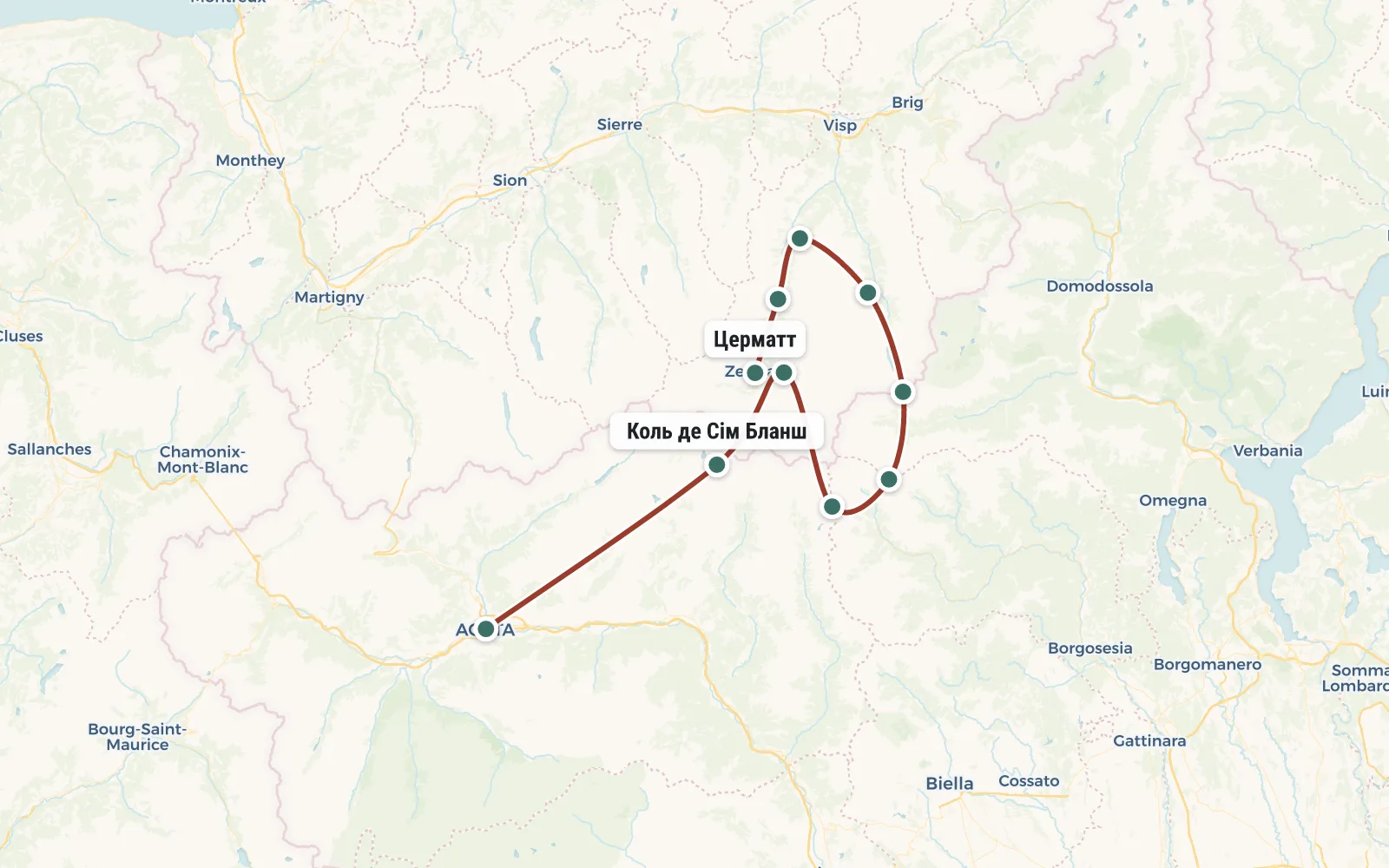 Open the map →
The GPS track is not digitised yet, the line is approximate (by key points).
Along the trailWhat you will see


Day by dayItinerary
1 Day 1. Zermatt
Group gathering in Zermatt (Switzerland). Arrival time does not matter. On the first day we don’t run away; upon arrival in Zermatt (altitude 1602 m) we put up tents at the campsite and just go for a walk around the city. If you have time, you can use the cable car and go up to one of the observation platforms overlooking the Matterhorn.
The camping is located 300 meters from the station. There are sockets, Wi-Fi, hot showers. Price - 15 francs per person. There is a good supermarket nearby. The nights in Zermatt are cold))

2 Day 2. Oberrothorn, Bösentrift, Randa
Today there will be no passes, we remain in the valley of the Matterwisp River. In the morning we gain altitude (2150 m) along the Findelbach stream, rise above Zermatt and then walk, maintaining altitude, along a well-equipped “health path” - benches for rest, signs with the names of trees and flowers, a wonderful view of Zermatt and the Matterhorn. So far everything is very civilized and there are quite a lot of vacationers. But don’t worry - very soon all this will end and the “game” and “toughness” will begin.
Having traversed the slopes of the Unterrothorn, Oberrothorn and Bösenrift mountains, we cross the valley of the Melliechbach stream and have lunch near the village of Otaffe. Next begins a beautiful and interesting section that requires increased attention. The trail goes through mudflows and ravines and you need to constantly be on the lookout for a stone flying from above. In the most dangerous areas, special tunnels, protective concrete canopies and other unexpected engineering structures are equipped for hikers.
3 Day 3. Durrenhorn, Grachen
Just a 10-minute walk from our parking lot is the longest suspended pedestrian bridge on this planet. As much as 490 meters! Moreover, the bridge was made not over the river, but over another landslide-prone gorge generated by the melting glaciers of Mount Dom (4545m). At the opposite side of the bridge we will stop to run into this very gorge for water. We pass the Europahütte shelter (2265 m, from 30 francs per bed). Behind the shelter, the trail crosses two more huge ravines and gradually gains altitude to 2600 meters. We have lunch at the equipped parking lot at the end of this relatively quiet section.
Then the brutality begins. We are again entering the rockfall zone. The rocks here are crumbly, as if they were assembled from individual bricks ranging in size from 10 cm to several meters. These bricks periodically crumble and the trail is a terrible stone chaos. If possible, we quickly pass through dangerous areas, but there are a lot of them here and we will get to a safe place no earlier than 2.5 hours after lunch. This is an observation deck (2470 m) with a mysterious monument to the “man with a spear” and a beautiful view of the new Aletschhorn massif (4195 m). He appeared in the north when we reached the mouth of the valley above Grächen.

4 Day 4. Saastal

5 Day 5. Monte Moro Pass (2853 m), Macugnaga (1310 m)

6 Day 6. Turlo pass (2738 m), Alanya (1173 m)

7 Day 7. Passo dei Salati (2980 m), Staffal (1840 m)

8 Day 8. Перевал Colle Bettaforca (2727 м), Saint Jacques (1689 м), Fiery

9 Day 9. Перевал Col de Cimes Blanches (2982 м), Озеро Белых вершин (2800 м)

10 Day 10. Breuil-Cervinia (2020 m)
From the camp it is a stone's throw to the cable car. On it we will go down to the resort village of Breuil-Cervinia and take a bus to the town of Chatillon. From there you can take buses to Milan (20 euros, 3 hours) or Geneva (100 euros, 5-6 hours). The hike around the Monte Rosa massif is completed, you can fly home.
Matterhorn and Monte Rosa hike map
Tour conditions (shelters, food, etc.)
To participate in this tour you will need a full set of equipment - tent, mat, sleeping bag. Initially, it is assumed that all overnight stays will be in tents, on the territory of campsites and shelters. On average it costs 10 Euros per person per night. For this money you get the opportunity to use: a lawn (for setting up a tent), a toilet, a shower and an outlet (for charging equipment). It is likely that in case of bad weather you will want to spend the night not in a tent, but inside the shelter. It will cost from 20 to 50 Euros per person. Therefore, it is better to take money for housing with a reserve.
It is prohibited to burn fires in the Alps. We will cook on gasoline burners, which the instructor will take with us. We partially bring the products from home, and partially buy them locally. The instructor is again responsible for organizing this process.
To participate in the hike you need a Schengen or biometric “visa-free” passport. If Schengen is one-time, then it is better to get Italian.
The group leader reserves the right to make changes to the route in depending on the weather, condition of the participants and other factors.
Transport
To get to the start of the route in Zermatt, you can fly to Geneva (Switzerland) or Milan (Italy), and then take the train. Geneva is closer, but tickets there are usually more expensive - from 250 to 300 dollars. With some luck, you can fly to Milan for $100 (for round-trip tickets). The train Geneva - Zermatt costs 50 Euro. From Milan you must first get to Aosta, and then change to another train to Zermatt, the fare costs about 80 Euros.
Tour cost: $300
For trip review - $20 discount.
Payment in two stages. First, prepay $50 to reserve your place in the group. The rest will be done at the meeting in Zematta. In case of premature departure from the route, recalculation is not made and money is not returned.
The tour price includes : instructor services, camp meals, public equipment (burner, boilers, first aid kit, group tent).
The tour price does not include: visa, travel and flights, meals in restaurants, visits to paid attractions (cable cars, museums), accommodation in campsites and shelters (on average 12 Euro per day), medical insurance.
The amount of mandatory additional expenses along the route (cable cars, buses, trains and campsites) is approximately 250 Euros. Plus you should take a couple hundred more just in case. As a result, the total budget for the trip (with all tickets, expenses, etc.) will be about 1000 Euros per person.
Additional materials
- List recommended equipment and clothing - the same as for hiking in Norway.
- Comparison of the cost and complexity of various foreign hikes - how to compare impressions?
Schedule
Application for participation


