Height above sea level
 One of these days me have asked about at what height above sea level there are Crimean cities of Yaltas, Alushta and Simferopol. Firstly I wished to wave away from this question, but curiosity has pushed me to check up, that writes the Internet on this theme. It has appeared, that it is practically impossible to find in a network of mentions of height of the majority of cities of the former Union. Amazed(struck) by this fact, I have decided to correct a situation.
Has for the beginning climbed in Vikipediju and has inquired that such height above sea level and from what sea it is necessary to consider(count). Here that there write:
One of these days me have asked about at what height above sea level there are Crimean cities of Yaltas, Alushta and Simferopol. Firstly I wished to wave away from this question, but curiosity has pushed me to check up, that writes the Internet on this theme. It has appeared, that it is practically impossible to find in a network of mentions of height of the majority of cities of the former Union. Amazed(struck) by this fact, I have decided to correct a situation.
Has for the beginning climbed in Vikipediju and has inquired that such height above sea level and from what sea it is necessary to consider(count). Here that there write:The height above sea level - coordinate in three-dimensional space (two others - breadth and a longitude), showing, at what level concerning the sea level accepted for a zero is this or that object.
The Baltic system of heights (BSV) - accepted in the USSR in 1977 system of absolute heights, which readout is conducted from zero futshtoka in Kronstadt. From this mark heights of basic geodetic items(points) which are designated on district by different geodetic signs are counted and put(rendered) on cards(maps). Now BSV it is used in Russia and a number(line) of other CIS countries.
 In the theory all is clear - necessary to take a detailed topographical card(map) and to look what heights there are designated. But where it(her) to take this card(map)?
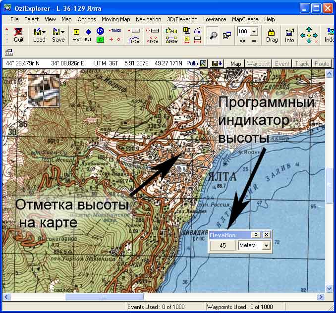
The first, that has occurred - to glance in OziExplorer. It is the special program for work with GPS (the satellite navigator). One of its(her) functions allows to define(determine) height simply specifying to the cursor a place on a card(map). With its(her) help I have easily found out, that Alushta is located at heights from 0 up to 130 meters above sea level. Yalta - from 0 up to 200 meters, Sevastopol - from 0 up to 100, Simferopol - on the average in 250 meters above sea level.
However this way not too universal. In fact on former there is a question " where to take a card(map)? ", this time digitized. Cards(maps) of Crimea at me were, and here with other world has not developed...
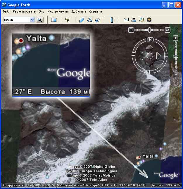
 the Answer laid on a surface, that is on the Internet literally. Any more the first year there operates(works) service Google Earth - the such digital globe of the terrestrial surface stuck together from photos from "space" height. There for certain there should be a function of definition of height. I skachal distribution kit Google Earth (the free-of-charge version), have established(installed) it(him) and have started studying the menu. Any vysotomerov there it has not appeared. Strange... Can it is necessary esteem the information(inquiry)? Too has not found :(
 Already almost having despaired, I have suddenly noticed in the bottom part of the screen shustro running tsiferki. Eureka!!! It also was vysotomer.
On pleasures I began to run on a card(map) and to measure height of all cities successively.
Height of Ekaterinburg above sea level - 250 meters.
Height of Moscow above sea level - 130 meters.
Saratov - 40
Makhachkala - 15
Krasnoyarsk - 140
perm - 150
Chelyabinsk - 250
Ufa - 125
Kazan - 90
Nizhni Novgorod - 70
Ivanovo - 130
Yaroslavl - 98
Voronezh - 104
Petersburg - 13
Arkhangelsk - 7
Novgorod - 28
Murom - 105
Height above sea level some cities of Ukraine:
Height of Kiev above sea level from 90 (a level of Dnepr) up to 190 (well-known Dneprovskie kruchi) meters.
Kharkov - 122
Chernovtsy - 240
Khmelnitskiy - 299
Ternopol - 336
Vinnitsa - 294
Cherkassy - 80
Krivoi Rog - 85
Zaporozhye - 75
Kherson - 50
Donetsk - 241
Dnepropetrovsk - 68
Sumy - 125
Poltava - 150
Chernigov - 117
In the western part of Ukraine I was interested with heights of such settlements:
Lvov - 270
Ivano-Frankovsk - 343
Uzhgorod - 187
Mukachevo - 181
Rahov - 430
JAsinja - 650
Pass Jablonitsky - 930
I hope you understand, that all obtained data are not too exact. Google Earth in fact not the professional tool with the guaranteed accuracy and authentically known errors. At it(her) absolutely other purposes.
Besides the term " height of city above sea level " rather conditional. In fact city it not the point, and huge object, which different areas have various height.